


Some forests are for walking through, and some are for remembering. The Ucieda oak forest, in the heart of the Saja-Besaya Natural Park, belongs to the second kind: one of the finest oak forests in Spain’s Cantabrian north, with protected “singular trees,” wooden footbridges over streams, a shepherds’ village abandoned centuries ago, and even legends of anjanas, the fairies of Cantabrian mythology.
In this deep dive, we’ll show you what to see in the forest, what the famous Ruta de los Puentes (Bridges Trail) is like, what history the village of Las Rozas hides, and where to eat gluten-free nearby, in Cabezón de la Sal.

🚗 Ucieda is in the rural interior of Cantabria, so the easiest way to get around is by car, whether it’s your own or a rental: compare options at Discover Cars.
🛡️ We never travel without IATI travel insurance (with a 5% discount for Glutendtrotters readers). It’s essential on any hiking trip.
📶 And if you’re visiting from outside Spain, a Holafly eSIM (also with a 5% discount for you) keeps you connected from the moment you arrive, which is handy in mountain areas.
An Oak Forest in the Saja-Besaya Natural Park
The Ucieda oak forest covers the Río de los Vados woodland, in the municipality of Ruente, and lies entirely within the Saja-Besaya Natural Park, the largest in Cantabria, with 24,500 hectares (roughly 60,500 acres) according to its founding decree. The dominant species are oak and beech, along with hazel trees, and the whole area is framed by the course of the Bayones River.
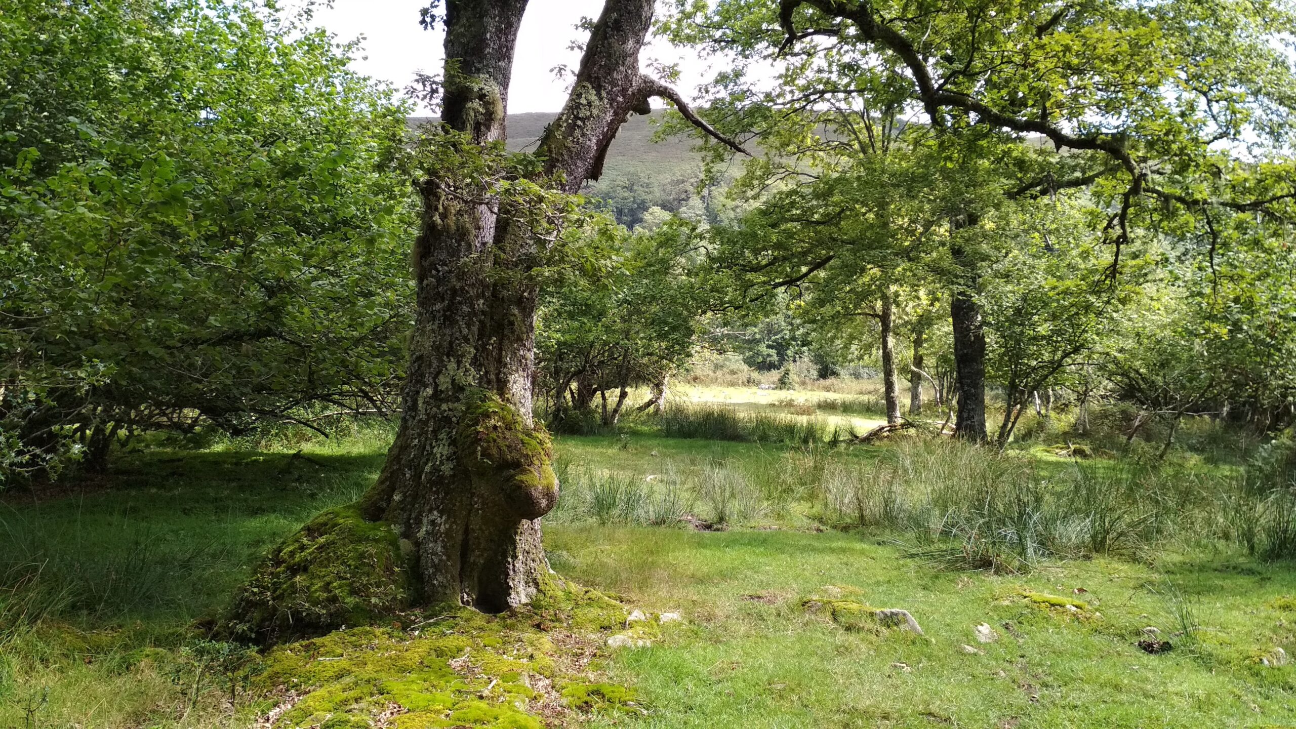
The star of the show is the common oak (Quercus robur, also known as English oak or pedunculate oak), which Cantabrians call cajiga and which is the region’s most representative forest species. In autumn, when the leaves turn shades of ocher and rust, the forest is at its best.
Singular Trees: The Roble Tumbado and La Estampauca
What makes this oak forest special are its monumental trees. The most famous is the Roble Tumbado (“Fallen Oak”), in the Bujilices area, listed in Cantabria’s catalog of singular trees: an old oak that toppled onto its trunk and kept growing, with vertical branches that have sprouted into new trees. You can see it with a short detour of about 100 meters (110 yards) from the main path.
Another monumental specimen on the same route is the beech of the Llana de Olar, known as “La Estampauca.”


The Ruta de los Puentes (Bridges Trail, PR-S 111)
The best-known hike is the Ruta de los Puentes, also called the Sendero de Rozas, a marked short-distance trail (PR-S 111) that starts at the Casa del Monte, in the Campa de Ucieda (Ucieda meadow). It begins on a track toward the Braña del Moral (a summer mountain pasture) and then heads into the forest, crossing streams on wooden footbridges, hence the name. Along the way you’ll come across brañas and shepherds’ huts, such as the Jou de la Collá, an old hut that shepherds used temporarily.
Watch out for the distance, because it can vary quite a bit depending on the route you choose. The Esencia de Cantabria information sheet gives about 18 km (11 miles), with low difficulty and 316 meters (about 1,040 ft) of elevation gain, while other guides put the route at around 13 km (8 miles). There’s also a shorter variant, just over 8 km (5 miles), that passes through Las Rozas.
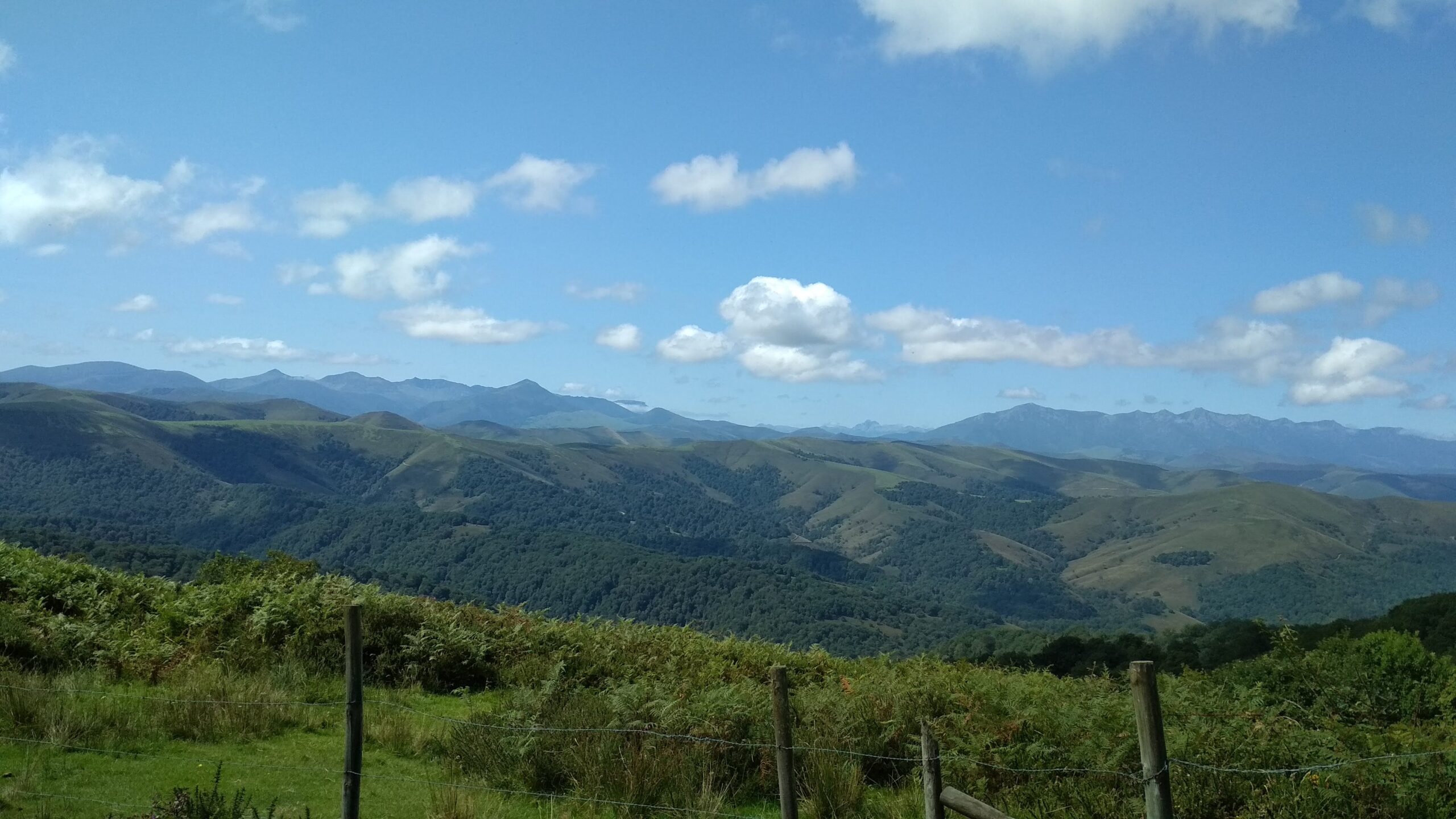
The most practical approach is to pay attention to the trail markers when you arrive and be clear about which route you’re going to take. We ended up hiking about 25 km (15.5 miles) because we got lost in the woods. Still, the adventure had its reward: we got some fantastic photos of the whole Ucieda forest. We used the Wikiloc app to guide us.
From the meadow there’s also a short, 1 km (0.6 mile) trail adapted for blind visitors, and there’s a drinking fountain right in the meadow.
IMPORTANT: Be very careful if you get lost like we did, and follow the trail markers closely. We know a couple who got lost and came across a brown bear. Luckily, nothing happened to them.
Las Rozas: The Abandoned Village Among the Oaks
Proof of the forest’s historical past is Las Rozas, an abandoned hamlet, now in ruins and almost swallowed by vegetation, reached by taking a branch off the Ruta de los Puentes. It was a settlement tied to livestock herding and the resources of the forest: it began as a cabin used by transhumant herders (who moved their flocks between seasonal pastures) and gradually became a permanent village, with wooden homes and roofs covered in vegetation. When the population moved down to the valley floor, it was permanently abandoned between the 17th and 18th centuries, depending on the source.
Like any place with history, it has its legend: they say its former inhabitants used to ride down to Ucieda on big billy goats. And in the forest’s folklore live the anjanas, the fairies of Cantabrian mythology.
Cocido Montañés Day
The Casa del Monte, or Campa de Ucieda, hosts Cocido Montañés Day every first Sunday of September. It’s a festival of regional tourist interest, built around the traditional Cantabrian mountain stew, with traditional games such as log chopping and tug-of-war. If you’re celiac, keep in mind that the compango (the cured meats and sausages that go into the stew) may include processed sausages: always ask about the ingredients before trying it, and confirm the date with the Ruente town hall.

Where to Eat Gluten-Free Near Ucieda
The closest option we’ve been able to verify is in Cabezón de la Sal: Restaurante La Retama. It has gluten-free options and gluten-free bread for people with allergies or intolerances. It isn’t affiliated with ACECAN (the Cantabrian Celiac Association), so be sure to tell the staff about your celiac disease when ordering and confirm their cross-contamination protocol.
How to Get There and When to Go
Take the CA-180 road from Cabezón de la Sal, and once in Ucieda, follow the signs to the Casa del Monte car park, the starting point for the trails. Since public transportation isn’t convenient in this area, the most practical option is to go by car.
The best time to visit is autumn, for the colors of the forest, although the trail can be hiked at any time of year. If it rains, keep in mind that the track can get muddy and slippery.
If you’re spending the day in the area, the Cantabria Sequoia Forest, in Cabezón de la Sal, is nearby, as is Bárcena Mayor, within the same natural park. Tell us in the comments if you already knew the Ucieda oak forest.
The Cantabria Sequoia Forest: The Fairy-Tale Spot You Didn’t Know Existed
Best Things to Do in Bárcena Mayor: A Cantabrian Journey
Gluten-Free Restaurants in Cantabria: A Local’s Guide for Celiacs


Frequently Asked Questions (FAQ)
Where is the Ucieda oak forest?
In the Río de los Vados woodland, in the municipality of Ruente (Cantabria), within the Saja-Besaya Natural Park. You get there on the CA-180 road from Cabezón de la Sal to the Casa del Monte, the starting point for the trails.
What is the Ruta de los Puentes (Bridges Trail) in Ucieda?
A marked short-distance trail (PR-S 111) that starts at the Casa del Monte, crosses streams on wooden footbridges, and passes singular trees such as the Roble Tumbado. Depending on the variant, its length ranges from just over 8 km (5 miles) to about 18 km (11 miles).
What is the Roble Tumbado?
A centuries-old oak listed in Cantabria’s catalog of singular trees that toppled onto its trunk and kept growing, so that vertical branches have sprouted from it and are now new trees. You can see it with a detour of about 100 meters (110 yards) from the Ruta de los Puentes.
What is the village of Las Rozas?
An abandoned livestock-herding settlement, now in ruins and almost covered by vegetation, reached by a branch off the Ruta de los Puentes. It began as a cabin for transhumant shepherds and was abandoned between the 17th and 18th centuries.
When is Cocido Montañés Day held in Ucieda?
On the first Sunday of September, at the Casa del Monte or Campa de Ucieda. It is a festival of regional tourist interest with traditional games such as log chopping and tug-of-war.


